About Antipodes Map
by Jorge Sanz on
This blogpost was migrated from the previous content management system that hosted this blog. If you want to check for old comments or to find anything looking weird please follow this link to check the Internet Wayback Machine.
We’ve been pretty quiet over the last year but that doesn’t mean we’ve been unoccupied. Last summer we (Pedro and me) participated with some friends on a hackathon with a project to give to teachers from our region a tool to help them to relocate, precalculating travelling times with OSRM and some open datasets, one of them a database of schools that our government published as a spreadsheet. That gave us the chance to work and improve our knowledge on the CartoDB Platform, we used their JavaScript API to place a Leaflet map with a parametrized map where the SQL that defined the layer changed depending on user selections. The project is online with some slides with further information, all in Spanish.
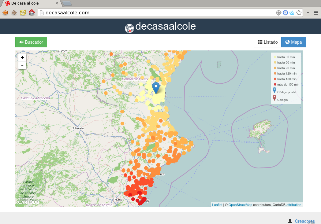
De Casa al Cole map
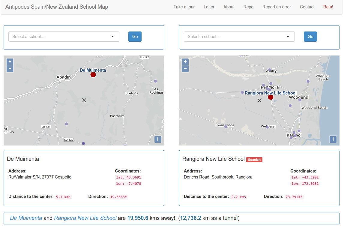
After that experience, and thanks to Pedro’s friendship with Carlos Galcerán, a Cuban GIS consultant working in New Zealand, we had the opportunity to put our brains working again for another pet project. The idea is easy, have you ever wondered who is on your antipodes? Yes, three quarters of our planet are oceans so the chance to have an inhabited antipodes is not high but here in Spain, it happens that half of the Iberian Peninsula is antipodal to New Zealand. Join that with the possibility to have data about schools on both countries and well, that’s reason enough for us to start playing. Imagine a geography class on primary school, say in the north coast of Galicia, where kids can contact their antipodal school in Christchurch and practice their English, or kiwis practicing their Spanish, both learning about our cultures, favorite sports, our differences.
We started with a dataset only for Galician schools and end up digging a national registry of schools to create a full dataset of schools for the country. That and the help of Carlos and some help from the Spanish Embassy in New Zealand, gave us all the data needed to set up two tables on CartoDB, so the last piece was just a web interface to develop. With the recent release of OpenLayers 3, and having played with it a bit before, I wanted to do something more complex. We’ll leave the technical details about data and software for another post or two. The application is available at http://antipodes.decasaalcole.com.

Antipodes Map
If you like the idea and know someone in New Zealand or Spain that could be interested, please spread the word. And of course, the data is available for reuse on CartoDB and the code is also on GitHub, ready to be reused on other lucky antipodal combinations, we’d love to see both data and software reused and improved!!
Updated: 2022-03-02, Version: 11d47a4.